Sunday 10th June
Spoke to people on 'Rag' net (8173) this morning about forthcoming passage to Fiji - may get someone about to enter Suva tomorrow to see how long it takes to get cruising permit - otherwise consensus seemed to be to head straight for Lautoka (if only one stop, to clear in & out , no cruising permit needed). Have a few days to firm up on where I'll make landfall in Viti Levu (Fiji), since either way I just head due west from here. E winds are forecast, so will be dead downwind.
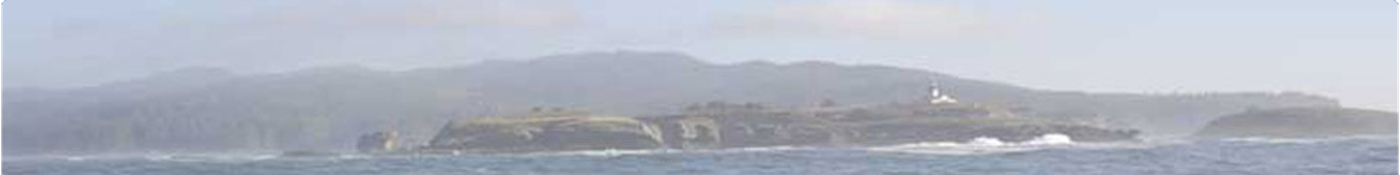
Presently anchored off a little island down in SW corner of Vava'u group (Ovaka) - feeling pretty uncomfortable in rather shallow water,not far from the beach and jetty & with very shallow reef area not far astern....!! Fortunately, wind is not strong just now - but will have to keep an eye on it overnight. Had to raise my anchor soon after getting here because local boat tied to jetty had a LONG stern anchor line which reached way out to under my chain - as we discovered when he left loaded
down with locals going back to Neiafu. (I'd seen the line on coming in & thought my anchor & chain was well clear of it!) Hadn't realized there was a problem with this Moorings-recommended anchorage until I arrived rather too late to go to any other.
I'd had a lovely relaxing Sunday at the other anchorage (Tapala), finishing a novel sitting out in the sunshine before ambling over here mid-afternoon. Alternative anchorages nearby don't have safe, easy access so are not very good for leaving from in early hours of morning - at least from here, once the anchor is raised, I head due west clear of all dangers to leave for a point north of Late island & on to the Southern Lau Group & Fiji. Must say, it felt very unsettling at times moving around
this area when the sun was in the wrong direction to see clearly where marked coral heads or reef areas near my path were!! It'll be nice to get out to the safety of deep ocean tomorrow!!
It has been very useful to have the accurate Moorings paper chart that Derek, the manager here, kindly gave me on Friday. Unusually, the Nobeltec chart is not detasiled enough & the Navionics charts used on the chartplotter, while far better & nice & clear, is positioned 2 cables N and W of where it should be for GPS input - not a lot, but enough!!
The new volcanic island reported by the skipper of 'Maiken' last August is temptingly close to here - but I'll restrain myself from going to see it....
I raised the outboard & dinghy, deflating it, around sunset so I'm ready to leave here at first light (if I've not already left earlier... I've just noticed that with the tide down a bit more, waves are breaking over some rocks uncomfortably close to me...!!) (Later: Well, I'm relieved to report that the depth here is still around 12-13 ft, having only once dropped (1-2 hrs ago) to 11.4ft for a time - so it looks as though the tide will not cause me a problem, nor the wind, which has been
up & down around E 5-10 knots max.... so maybe I can afford to have a decent sleep before taking off tomorrow! It's pitch black outside - feels a bit weird out here on anchor - no moon & no shore lights, just a light-house flashing every 5 secs off to the west - my path out tomorrow..)
Mon 11th June
Got away early as planned, in good wind, and the volcanic shape of Late Island was fading away to the ESE as night fell. The new volcanic island is about 20ml S of Late Island - I passed over a fault line with lots of recent volcanic activity with some trepidation!
Sat in the cockpit as the sun set, watching the clouds, with delicate colours fading as the night fell. Stars appeared - bright Venus in the west and a really bright star (planet? Saturn?) high up in the East by Sagittarius. The Southern Cross is high up - but what a DARK night, with so many stars but no moon...! Always feels odd to be sailing along, often very fast, in the pitch dark, with no possibility of seeing anything ahead... Definitely a time to be sure you're keeping well off any
dangers... land, reefs...!! I'd poled out the genoa earlier so the sails were set up nicely for downwind overnight - so long as no squalls come along... (Amazing... I'd JUST written that on Thurs evening when we got hit by a squall - sudden backing of strong wind under a dirty black cloud... so there we were, both sails backed, heading off north towards a big reef in the distance.... had to rush up on deck to sort things out!! Decided to reef down for overnight peace of mind... too many grey
clouds about.)
My position report to Winlink Monday evening:
TIME: 2007/06/10 05:49 (GMT)
LATITUDE: 18-44.51S
LONGITUDE: 174-05.71W
MARINE: YES
WIND_SPEED: 8
WIND_DIR: E
CLOUDS: 5%
BARO: 1013
TREND: 0
AIR_TEMP: 27.0C
COMMENT: Anchored off Ovaka island, Vava'u group, Tonga. To Fiji at daybreak
Tues/Wed
At 0343, I saw two bright points of light on the horizon astern - wondered what they could be - they got brighter & larger.... & then joined up to form a delicate crescent moon 'flat on its back'!!
After a morning of light & variable winds, with a few light showers, the wind settled down to a nice ESE 4-5. Good 'tradewind sailing' at last - which continued over into Wed also - very nice day's sail in sunshine with a much-reduced swell! The only problem arose overnight because I was heading towards the reefs of the Southern Lau Group - I had to reef the sails to slow down, so as to arrive there in daylight - I didn't dare take chances with the charts possibly being well off-position since
the passage through the group of atolls was only a few miles wide - too many stories of charts in this region being several miles off (Met a couple who wrecked their yacht last year on Niue reefs - they said they gave it a 2-3 mile clearance but their chart was 5 miles out...)
At 1156 GMT (2356 local time) Wednesday, "Nereida" passed into the Eastern hemisphere - we'd crossed the real Dateline (180deg E or W, take your pick!) at 18deg 27.55'S and are now East of Greenwich. Fiji time is the same as NZ at GMT+12hr (except Nov-Feb when they go into 'summertime' so as not to be beaten by Tonga into the New Year!!! Introduced for the Millenium celebrations!)
Thursday
I had to be careful of my route - too many isolated islands & BIG reefs around Fiji area.
At 0420, I'd taken the pole down after the wind had veered suddenly & backed the genoa - presumably under a cloud. I had to work on the sails in the moonless dark using my headlamp for light - what a blessing that headlamp is, leaving hands free for work..!
The rest of the day was a delight in that it was mainly sunny & the wind went more SE, up to 15-20 knots, so we made excellent speed, broad reaching, often at 6-7knots. Of course, the downside of constant strong wind is that the swell builds up - back to a 'bumpy' ride again!!
The ongoing problem I've had over Wed & Thurs is my Winlink computer deciding it's giving up the ghost - occasionally working but mainly forever shutting itself down suddenly after 'blinking' at me, often refusing to start up again, so it's become totally unreliable. Since all my emailing & obtaining of weather info has been done on that computer, this has been a major headache. I managed yesterday to get the info off that computer (emails/addresses), using an external hard drive (which it is
currently no longer 'seeing'!) & onto my 2nd computer - but that PC is also misbehaving when I connect it into the HF radio, 'hanging up' when I try to connect on 14MHz.... grrr!!!... and telling me that 'Com port 4 is already occupied' (of course, it is... that's the radio connection...!) & it keeps 'hanging up' when I try to close it down - re-starting the PC being the only way I can then re-connect into Winlink... so my 'log' has been delayed as a result.... Oh, and, of course, that computer
requires the inverter since it blows the 12V circuit whenever I try to power it that way, so that's a major power requirement now... Oh, what fun computers are...!
Oh-so-dark-8pm!! I just had to gybe around Mbengga Barrier Reef in 20+ knots - think it 'only' took 30 mins, since I delayed gybing the genoa for a bit to keep well away from the reef and also had to reorganize the preventer before deploying the mains'l on the new starboard tack, but it felt like an hour or so!! Fortunately, I could see the flashing light on the S. end of the reef a couple of miles away, which was comforting, but I now have to make sure I don't get too close to another (unlit)
reef, east of Vatulele Island to the NW of here. The radar is showing that the GPS positioning on the C70 chartplotter is OK - always a relief to see that at night.
Expect to be safely in port at Lautoka tomorrow around midday - major reef entrance beforehand and then we'll see how well the Fijians conduct their clearance-in & out procedures... I hear there's a public holiday on Monday.
Let's see if I can send this off....